
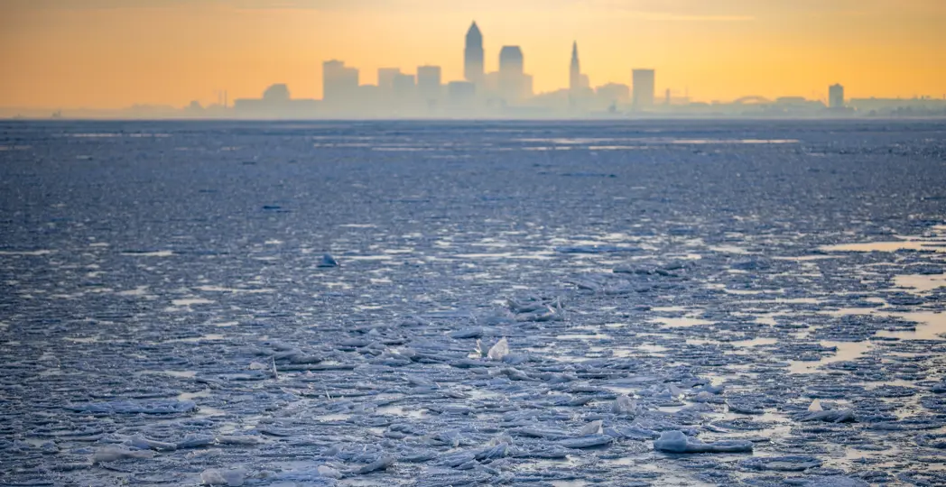
(Photo: Erik Drost)
Cleveland, OH — February 8, 2026
Lake Erie surged toward an extremely rare complete ice freeze this week as a prolonged Arctic cold front pushed its ice coverage to about 96 percent by February 5, the highest since 1996.
Satellite imagery from NOAA showed a nearly 130‑kilometer (80 mile) crack forming on the ice surface on February 8 — a striking sign of how far the lake has frozen after weeks of temperatures well below seasonal norms.
Ice analysts say the overwhelming majority of the lake’s surface freezing resulted from consistent sub‑freezing air masses across the region from mid‑January into early February. Repeated shots of Arctic air drove ice extent from only a few percent in early January to record levels as the chilling pattern persisted.
The extensive freeze has significantly reduced lake‑effect snow in many parts of the region, as large expanses of solid ice limit moisture transfer from open water into the air — a shift that affected snowfall patterns across northeast Ohio and western New York.
Meteorologists warn that while ice cover might fall short of 100 percent, the heavy ice is likely to linger well into mid‑February before spring warmth arrives. Residents are urged to exercise extreme caution near the ice, as large cracks and unstable areas present safety hazards despite the solid white appearance.